Hamta Pass-Baralacha La Trek
Duration: 12 days trek & 3 days Safari
Best season: April to October
Region: Kullu Manali / Lahaul Valley
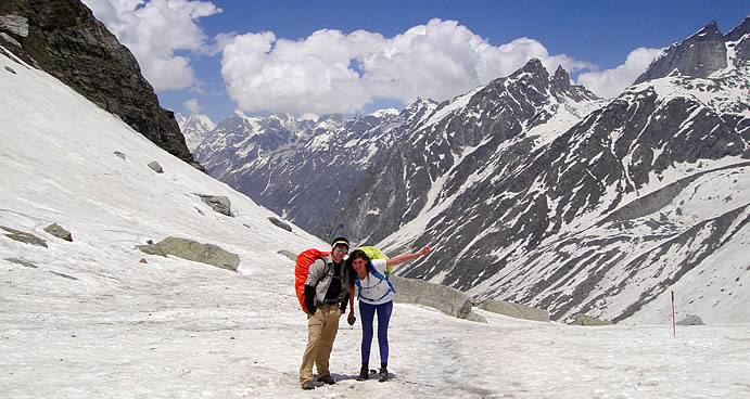
This is one of the most delightful treks in the Manali Region, affording views of lush green valleys, snow-capped mountain Ranges and barren hills. Leaving the Manali valley, the trek proceeds through forests, meadows etc. As soon as we arrive at the top of the Hampta Pass, one can have a spectacular view of the Inderkila & Inderasan mountain peaks.The Trek takes us over the majestic Himalayas, crossing over the Hamta Pass (4,268 m) to reach the remote Lahaul & Spiti Valley. The Hamta Trek was the traditional route between Lahaul and Kullu Valley before the road was made over the Rohtang Pass. After we reach the cold and dry mountain dessert of Spiti and Lahaul Valley, we pass the Bara Shigri Glacier, the biggest glacier in Himachal Pradesh. Our way leads us further to the beautiful Chandratal Lake at an altitude of 4270 meters. Chandratal, which means the Lake of Moon, is shaped like a half moon and is set on a large meadow of edelweiss within a lower ridge and the main Kunzum range. From here you have a great view of high mountains and the Baralacha glacier which is the source of the Chandra River. The trek ends on top of the Baralacha Pass (4830) which marks our highest point of the trek. From there we will go back by jeep having a stopover in the capital of Lahaul Valley Keylong to visit the beautiful monasteries in the nearer surrounding.
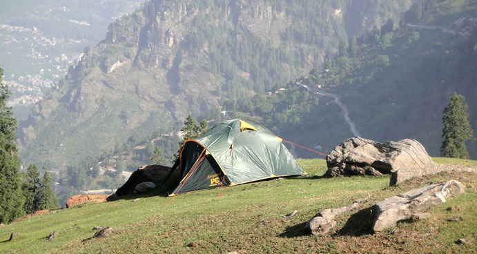
Day 1 Drive to Jagatsukh (2015m) 7 km away from Manali Jagatsukh to Tilgan (2430m) 5 to 6 hours trek
Uphill, trail leads through forest and passes small old villages. Great view of green Kullu Valley.
Day 2 Tilgan to Sarotu (3380m) 6 to 7 hours trek
First steep climb through forest, then gradual walk above tree line. Nice view, great spot for photographer.
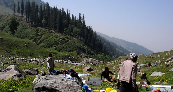
Day 3 Sarotu to Chikka (3300m) 6 hours trek
Downhill, crossing of chilly river.
Day 4 Chikka to Balu-Ka-Gera (3770m) 5 hours trek
Gradual climb up along the river through meadows with colorful flowers. At campsite great view of snow covered mountains.
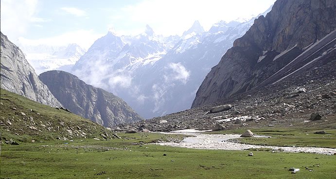
Day 5 Balu Ghera to Shia Gauru (Over Hamta Pass) (4268 m) 6 hours trek
Steep ascent up to Hamta pass. Later descent on the other side in steep slopes down to camp site. Mt Deo Tibba and Indrasan are visible along with a wide view of the Lahaul Valley.
Day 6 Shia Gauru to Chattru (3560 m) 4 hours trek downhill
Nice and easy descend down to Chattru. Crossing of river.
Day 7 Chattru to Bara Dara (3780 m) 4 to 5 hours
Way on road along the rapid Chandra River through the dry mountain dessert with high snow covered mountains on both sides. Nice view of Shigri Glacier, a mountainous mass of solid ice, more than a kilometer wide and extending over a distance of ten kilometers.
Day 8 Bara Dara to Batal (3960 m) 4 hours
As day before. reaching Batal a small place with only two Dabha Wallas, situated on the foot of Rohtang Pass.
Day 9 Batal to Chandratal (4270 m) 4 hours
Today we have a gradual walk with great views of many mountains above 6000 meters. We will camp at the Chandratal Lake, which is of exquisite beauty.
Day 10 Chandratal to Tokpo Gangmo (4320 m) 5 hours
After a moderate trek with good views of mountain peaks and glaciers we end on the river Topka Gangmo. In Tibetan Topka means river and Gongma means big.
Day 11 Topka Gangmo to Topko Yangmo (4640 mtrs) 5 hours
The trek today involves an early morning river crossing, since the water level is low in the morning. We reach the next river in the afternoon. Nice View of the C.B. Range, the Mulkilla Range and of Dhaka Glacier.
Day 12 Topko Yangmo to Baralacha La (4830 m) 5 to 6 hours Trek
Baralacha is an interesting 8 km long pass and gives rise to three rivers: Chandra, Bhaga and Yuman. Baralacha means “pass with cross roads on summit”. Roads from Zanskar, Ladakh, Spiti and Lahaul meet on top of that pass. It is the highest point of the trek.
Day 13 Baralacha La to Keylong by Jeep 72 km
We take a jeep and go to Keylong on the way we pass the Suraj Lake, source of the Bhaga River. In Evening arrival in Keylong, overnight in Hotel.
Day 14 Sightseeing around Keylong (3350 m) Visit of:
Gondla (18 km), on the right bank of the river Chandra, the tall imposing structure up on a hill is also a fortification.Kardang (5 km), the largest monastery in the area, it has barrel sized prayer drums that the monks turn during their perambulations, paintings, ancient weapons, musical instruments and large life-size statues of Buddha and the Bodhisattvas.Shashur (3km), monastery, perched upon a mountain-side, nearly 600 m above the valley, opposite Khardang,
Day 15 Keylong to Manali 115 km
Journey back to Manali over Rohtang Pass (3980 m)